mosaic
I = mosaic(lon, lat; pt_radius=6371007.0, provider="", zoom::Int=0, cache::String="",
           mapwidth=15, dpi=96, verbose::Int=0, kw...)
I = mosaic(D::GMTdataset; pt_radius=6371007.0, provider="", zoom::Int=0, cache::String="",
mapwidth=15, dpi=96, verbose::Int=0, kw...)I = mosaic(G::Union{GMTgrid, GMTimage}; pt_radius=6371007.0, provider="", zoom::Int=0, cache::String="",
mapwidth=15, dpi=96, verbose::Int=0, kw...)I = mosaic(region=??, ..., kw...)I = mosaic([zoom::Int=??])Get image tiles from a web map tiles provider for given longitude, latitude coordinates.
Arguments
lon&lat:lon, lattwo scalars with the coordinates of region of interest center. To completly define the image area see theneighborsormosaicoption below.lon, latare two elements vector or matrix with the region's[lon_min, lon_max], [lat_min, lat_max].Instead of two arguments, pass just one containing a GMTdataset obtained with the
geocoderfunction. Example:mosaic(D, ...)or, if the search withgeocoderwas sufficiently generic (see its docs),mosaic(D, bbox=true)to use the BoundingBox returned by the query.bboxsupportsbb,BBorBoundingBoxas aliases.Yet another alternative is to pass either a GMTgrid or a GMTimage with a valid projection, and it doesn't need to be in geographic coordinates. Coordinates in other reference systems will be converted to geogs.
Finaly, all of the above options can be skipped if the keyword
regionis used. Note that this option is the same as in, for example, the coast module. And that means we can use it with earthregions arguments. e.g.region="IT"is a valid option and will get the tiles needed to build an image of Italy.
pt_radius: The planetary radius. Defaults to Earth's WGS84 authalic radius (6371007 m).
provider: Tile provider name. Currently available options are (but for more details see the docs of thegetproviderfunction, i.e.? getprovider):"Bing" (the default), "OSM", "Esri" or a custom provider.
A
Providertype from the TileProviders.jl package. You must consult the documentation of that package for more details on how to choose a provider.
zoom: Zoom level (0 for automatic). A number between 0 and ~19. The maximum is provider and area dependent. Ifzoom=0, the zoom level is computed automatically based on themapwidthanddpioptions.
cache: Full name of the the cache directory where to save the downloaded tiles. If empty, a cache directory is created in the system's TMP directory. Ifcache="gmt"the cache directory is created in~/.gmt/cache_tileserver. NOTE: this normally is neeaded only for the first time you run this function when, ifcache!="", the cache dir location is saved in the~./gmt/tiles_cache_dir.txtfile and used in subsequent calls.
mapwidth: Map width in cm. Used together with thedpioption to automatically compute the zoom level.
dpi: Dots per inch. Used together with themapwidthoption to automatically compute the zoom level.
verbose: Verbosity level. A number between 0 and 2. Print out info while downloading the image files. Silent when geting files from local cache unlessverbose=2, where it prints out info about the files found in the cache.
kwargs (kw...)
neighborsormosaic: Whenlonandlatare scalars, this option specifies the number of neighbors of the tile containing the query point to download. Normally this should be an odd number, but it can take the form of a matrix and the number of tiles is then determined by the number of rows and columns.
mercormercator: Return tiled image in Mercator coordinates. The default is to project it back to geographical coordinates.
looseorloose_bounds: By default we return an image with the limits requested in thelonandlatarguments. This option makes it return an image with the limits that are determined by those of the tiles that intersect the requested region. Note that this does not work for point queries.
quadonly: Return only the quadtree string. A string or a matrix of strings when number of tiles > 1. Other from the quadtree string this option return also thedecimal_adress, lon, lat, x, ythat are: the XYZ tiles coordinates, the longitude, latitude , mercator X and Y coordinates in meters of first tile.
tilesmeshormeshtilesormesh: Return a GMTdataset with the mesh of tiles.
Returns
I: A GMTimage element or the output of thequadonlyormeshoptions explained above.
Examples
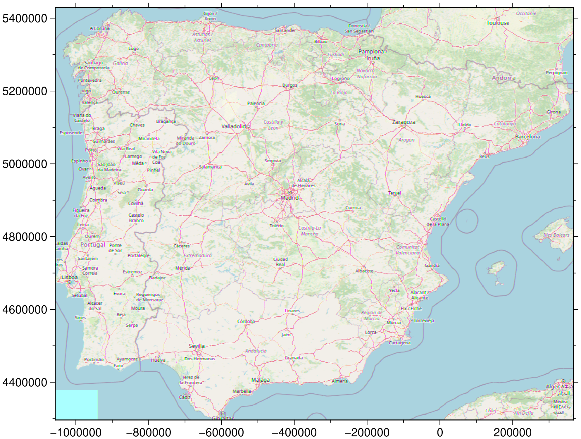
Make a figure with OpenStreetMap over Iberia maintaining the original spherical Mercator projection.
using GMT

I = mosaic([-9.5, 3.3], [36.0, 43.8], provider=:OSM, zoom=7, merc=true)
viz(I)
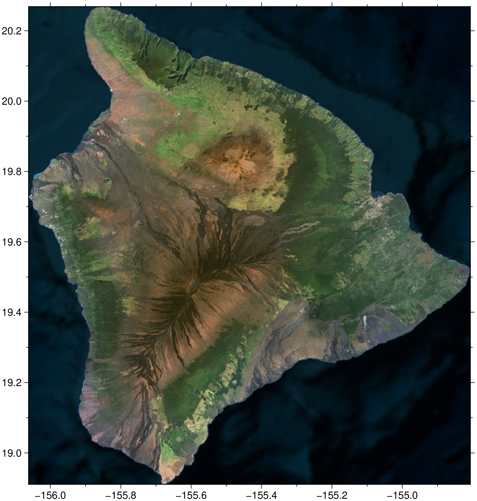
Make a figure of the Big Island of Hawaii using the default Bing images. In this case
we use the geocoder function to give us the map limits
using GMT

# Get the geographical limits of the Big Island in Hawaii
D = geocoder("Big Island Hawaii, USA");

# Get the image tiles of the Big Island in Hawaii using the Bing provider and automatic zoom level
I = mosaic(D, bbox=true);

viz(I)
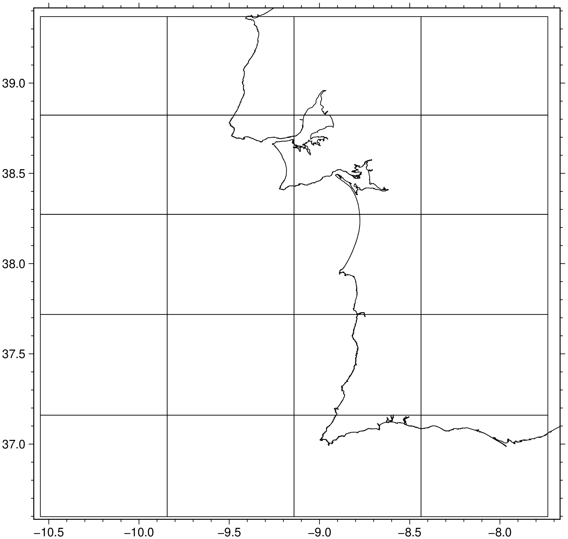
Show only the tilles limits over a selected zone/zoom level.
using GMT

D = mosaic(region=(-10, -8, 37, 39), zoom=9, mesh=true);
viz(D, coast=true)
Print a table with the zoom level 10 basic characteristics.
using GMT

mosaic(zoom=10)
┌───────┬────────────────┬────────────┬────────────────┬────────────────────┐
│ Level │     Tile width │  m / pixel │         ~Scale │        Examples of │
│       │ ° of longitude │ on Equator │                │ areas to represent │
├───────┼────────────────┼────────────┼────────────────┼────────────────────┤
│    10 │          0.352 │    153.054 │ 1:500 thousand │  metropolitan area │
└───────┴────────────────┴────────────┴────────────────┴────────────────────┘
See Also
geocoderThese docs were autogenerated using GMT: v1.33.1


