Web Map Service
wmsread(wms::WMS; layer=?, kwargs...)Read the layer number provided by the service from which the wms type was created.
Parameters
wms: A WMS type obtained from thewmsinfofunction.layer: The layer number or layer name of interest from those provided by the WMS service. That is, both of these forms are allowed:layer=3orlayer="Invented layer name"
kwargs is the keywords/values pairs used to set
region | limits: The region limits. Options are:A Tuple or Array with 4 elements defining the
(xmin, xmax, ymin, ymax)or a string defining the limits in all ways that GMT can recognize.When the layer has the data projected, we can pass a Tuple or Array with 3 elements
(lon0, lat0, width), where first two set the center of a square in geographical coordinates and the third (width) is the width of that box in meters.A $mosaic$ tile name in the form $X,Y,Z$ or a quadtree. Example: $region="7829,6374,14"$. See the $mosaic$ function manual for more information. This form also sets the default cellsize for that tile. NOTE: this is a geographical coordinates only that implicitly sets $geog=true$. See below on how to change the default resolution.
cellsize | pixelsize | resolution | res: Sets the requested cell size in meters [default]. Use a string appended with a 'd' (e.g.resolution="0.001d") if the resolution is given in degrees. This way works only when the layer is in geogs.zoom or refine: When the region is derived from a $mosaic$ tile name, the default is to get an image with 256 columns and n rows where n depends on latitude. So, either the area is large and consequently the resolution is low, or the inverse (small area and resolution is high). To change this status, use thezoomorrefineoptions.zoom: an integer >= 1 that for each increment duplicates the base resolution by 2. e.g.,zoom=2quadruplicates the default resolution. This option is almost redundant with therefine, but is offered for consistency with the $mosaic$ function.refine: an integer >= 2 multiplication factor that is used to increment the resolution by factor. e.g.,refine=2duplicates the image resolution.
size: Alternatively to the thecellsizeuse this option, a tuple or array with two elements, to specify the image dimensions. Example,size=(1200, 100)to get an image with 1200 rows and 100 columns.time: Some services provide data along time. Use this option to provide a time string as provided by DateTime. For example:time=string(DateTime(2021,10,29))geog | force_geog | forcegeog: Force the requested layer to be in geographical coordinates. This is useful when the data is in projected coordinates (check that by asking the contents ofwms.layer[layer].srs) but want to pass aregionin geogs. Warning: there is no guarantee that this always works.
Returns
A GMTimage
Examples
wms = wmsinfo("http://tiles.maps.eox.at/wms?")
img = wmsread(wms, layer=3, region=(-10,-5,37,44), pixelsize=500);

# Retrieve and display a MODIS image
wms = wmsinfo("https://gibs-c.earthdata.nasa.gov/wms/epsg4326/best/wms.cgi");
img = wmsread(wms, layer="MODIS_Terra_CorrectedReflectance_TrueColor", region=(9,22,32,43), time="2021-10-29T00:00:00", pixelsize=750);
imshow(img, proj=:guess)
Download and display a Sentinel 2 image
First we have to start by fetching the information provided by this Web Map Server
julia> wms = wmsinfo("http://tiles.maps.eox.at/wms?")
serverURL:      http://tiles.maps.eox.at/wms?
OnlineResource: http://tiles.maps.eox.at/?
version:        1.1.1
request:        GetMap
layernames:     ["s2cloudless-2018_3857", "coastline", "s2cloudless-2020", "osm_3857", "s2cloudless_3857", "terrain_3857", "overlay_base_bright_3857", "hydrography", "graticules", "overlay_3857", "bluemarble", "coastline_black", "s2cloudless-2017_3857", "streets_3857", "overlay_bright", "s2cloudless-2019_3857", "overlay", "blackmarble_3857", "hydrography_3857", "s2cloudless-2017", "streets", "s2cloudless-2018", "s2cloudless-2019", "osm", "blackmarble", "terrain-light_3857", "s2cloudless-2020_3857_512", "bluemarble_3857", "overlay_base_3857", "s2cloudless", "terrain", "overlay_bright_3857", "coastline_3857", "s2cloudless-2020_3857", "magnetic_graticules", "terrain-light", "overlay_base_bright", "overlay_base"]

layer:  38 Layers. Use layer[k] to see the contents of layer k
Next, let's look at the contents of the layer 3
julia> wms.layer[3]
name:   s2cloudless-2020
title:  Sentinel-2 cloudless layer for 2020 by EOX - 4326
srs:    EPSG:4326
crs:
bbox:   (-180.0, 180.0, -90.0, 90.0)
imgformat:      image/jpeg
tilesize:       256
overviewcount:  17
resolution:     5.3644180298e-6
tiled:  true
transparent:    false
And finaly download and display a low-resolution image of that layer 3 at 1500 m/pixel.
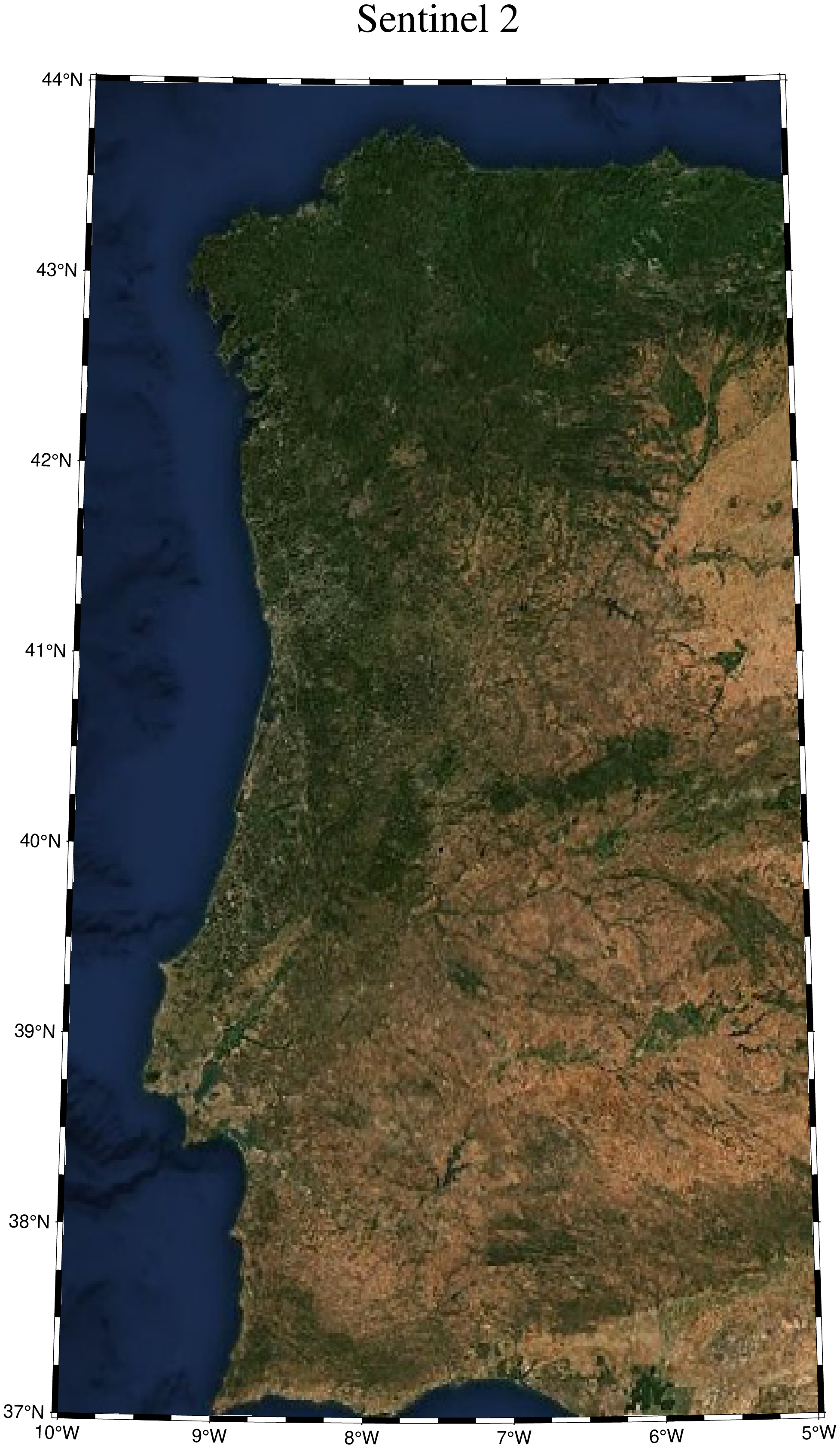
using GMT
wms = wmsinfo("http://tiles.maps.eox.at/wms?");
img = wmsread(wms, layer=3, region=(-10,-5,37,44), pixelsize=1500);
imshow(img, proj=:guess, title="Sentinel 2")
Download and display a MODIS image
Use the a WMS from NASA and download a MODIS Terra reflectance image from 29 October 2021
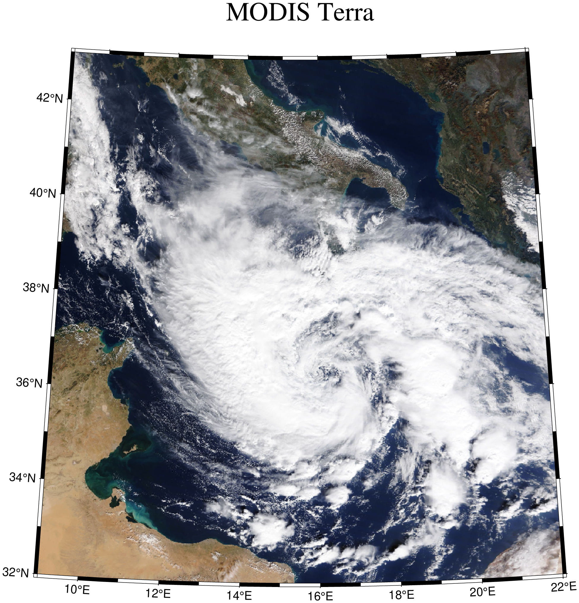
using GMT
wms = wmsinfo("https://gibs-c.earthdata.nasa.gov/wms/epsg4326/best/wms.cgi");
img = wmsread(wms, layer="MODIS_Terra_CorrectedReflectance_TrueColor", region=(9,22,32,43), time="2021-10-29T00:00:00", pixelsize=1500);
imshow(img, proj=:guess, title="MODIS Terra")
These docs were autogenerated using GMT: v1.33.1